
|
|

Hurricane Ivan Advisory
National Hurricane Center Miami Fl
8 AM EDT SAT SEP 11 2004
Updated regularly: Satellite image of Hurricane Ivan
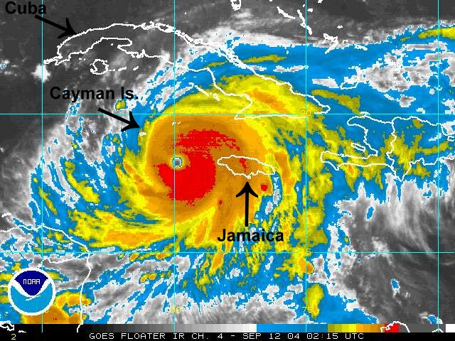
...Eye of dangerous hurricane Ivan just offshore the southwest coast of Jamaica...Heading for the Cayman islands...
A hurricane warning remains in effect for Jamaica and the Cayman Islands.
A hurricane watch remains in effect for Cuba including the isle of youth.
A tropical storm warning is in effect for Cuba from Cabo Cruz to Cienfuegos.
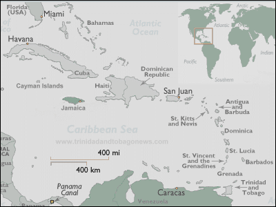
Interests in the northwestern Caribbean Sea...As well as in the eastern Gulf of Mexico...Should closely monitor the progress of dangerous hurricane Ivan.
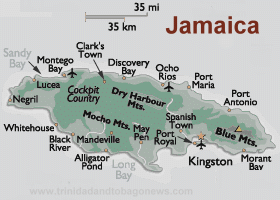
At 8 am EDT...1200z...The eye of hurricane Ivan was located near latitude 17.7 north...Longitude 78.4 west. This position is just south of the western tip of Jamaica or about 60 miles...95 km... South of Montego Bay Jamaica.
Ivan is moving toward the west-northwest track near 8 mph...13km/hr. On this track...Ivan should move near the Cayman Islands in about 24 hours.
Maximum sustained winds are near 150 mph...240 km/hr...With higher gusts. Some fluctuations in strength are expected...But Ivan could become stronger during the next 24 hours.
Hurricane force winds extend outward up to 45 miles... 75 km...From the center...And tropical storm force winds extend outward up to 175 miles...280 km.
Estimated minimum central pressure is 923 mb...27.26 inches.
Storm surge flooding of 5 to 8 feet above normal tide levels...Along with large and dangerous battering waves are occurring primarily along the south coast of Jamaica.
Rainfall amounts of 8 to 12 inches...Possibly causing life-threatening flash floods and mud slides...Can be expected along the path of Ivan.
Repeating the 8 am EDT position...17.7 n... 78.4 w. Movement toward...West-northwest near 10 mph. Maximum sustained winds...150 mph. Minimum central pressure...923mb.
For storm information specific to your area...Please monitor products issued by your local weather office.
The next advisory will be issued by the national hurricane center at 11 am edt.

| NOTE: In accordance with Title 17 U.S.C. section 107 this material is distributed without profit or payment to those
who have expressed a prior interest in receiving this information for non-profit research and educational purposes only.
For more information go to: http://www.law.cornell.edu/uscode/17/107.shtml. If you wish to use copyrighted material
from this site for purposes of your own that go beyond fair use you must obtain permission from the copyright owner. |